
Start a Union Street Search
Begin with the address itself. The postal form confirms a usable delivery format, not a person at that location. The next task is to place the address in Union Township, Union County, and its tax-map geography. That order matters because Union postal labels, Union municipal limits, and Union recorded land descriptions do not always use the same language. The result is a defensible street-by-street trail rather than a loose collection of names.
The strongest sequence moves from place to record, then from record to history. It also keeps Union ownership, Union occupancy, and Union civic geography separate. A taxpayer may receive correspondence somewhere else, and a dated deed does not identify every person who lived at the address. The Union street directory is most useful when its sources stay distinct.
- Use the USPS ZIP Lookup to standardize the full Union address. Save the submitted form and the lookup date; a ZIP answer never confirms a resident or company.
- Search NJGIN by Union address, then select Union County and Union Township if a same-name result needs narrowing. Record the block, lot, qualification, map date, and any redaction notice.
- Read the adjacent parcel and road geometry in the Union County map service. This establishes a Union street segment and public civic geography without turning it into a roster.
- Use the County Clerk index to test the Union parcel trail through grantor and grantee searches. Work from an instrument or legal description when a street address is absent from a deed.
- For an earlier household lead, inspect the street section of the Union Public Library directories and then compare the same Union address in nearby available volumes.
Note: A change in any one source should be dated before it is treated as a change in a household.
Union Street Parcel Fields
The Union Township Assessor maintains Union ownership and mailing information, assessment data, building and lot dimensions, tax maps, deductions, and appeals material. No municipal interactive owner or address search was found. For an online starting point, New Jersey’s Property Explorer supports address, county, municipality, block, and lot modes, while the state property-transparency material supplies annual assessment and tax context. Treat annual values as tax information, not market value or occupancy evidence.
Use the Union parcel key before searching names. NJGIN’s PAMS PIN joins county, municipality, block, lot, and qualification. It is a useful cross-reference, but parcel polygons are not legal surveys and Union County remains the parcel steward. A blank owner field can be a Daniel’s Law redaction, not an invitation to reconstruct protected information from unrelated sources.
| Union street search field | How to use it |
|---|---|
| Union street address | Primary location key in NJGIN Property Explorer; the live field label was not captured. |
| Union County and municipality | Choose Union County and Union Township to avoid another New Jersey place named Union. |
| Union block and lot | Use the Union tax-map parcel key to compare a deed, map, and annual property data. |
| Qualification and PAMS PIN | Retain when supplied so a Union parcel component can be distinguished from the main lot. |
| Union situs and mailing address | Keep separate: situs is the parcel location, while mailing data concerns tax correspondence. |
| Assessment and classification | Read as Union year-specific tax context; later changes can miss a certified-list snapshot. |
The NJGIN parcel documentation explains the statewide schema, search modes, PAMS PIN, and state-hosted redaction rules.
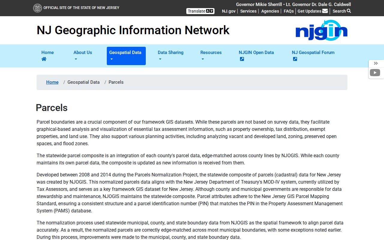
This Union street directory image supports the parcel-first step, where a map key provides a stable bridge to a recorded land instrument.
Union Street Map Layers
The Union County Public Map Service lists parcels, blocks and lots, roads, municipal wards and districts, voting polls, zoning, tax-map attachments, parks, cemeteries, water features, and other layers. For a Union street search, turn on only the layers that answer the question. Parcel edges and road names help place an address. Ward, district, and poll layers provide civic context. They do not identify a household or prove registration at a parcel.
Union map geometry is especially useful where a road bends, a subdivision has a separate name, or a deed uses block-and-lot language rather than a modern mailing address. Capture the layer date and source because NJGIN and local data products follow update cycles. When an address is near a postal boundary, compare the Union municipal layer and tax map rather than assuming the postal city establishes jurisdiction.
Note: Keep a map result with its visible layer date, since geometry and tax attributes can refresh on different schedules.
Union Street Deed Chain
The Union County Clerk name index covers June 1, 1977 through the current date shown by the system. It accepts a required last name, optional first name, exact, starts-with, or Soundex matching, a date range, party role, document-type selections, and results-per-page controls. Search a known party as both grantee and grantor, narrow the date range, and select Deed when the question is title. A mortgage or lien can be relevant to financing, but it does not establish title.
Grantor means the party transferring an interest; grantee means the party receiving it. Record the Union party role, recording date, instrument number, document type, book and page when shown, legal-description language, and the image-access status. Then use a prior reference or the next deed in the chain to move backward. The Union public index is not the same as unrestricted document images, because full viewing requires sign-in.
The Clerk’s name-search screen shows the party, date, and document filters used to narrow a Union street directory deed search.
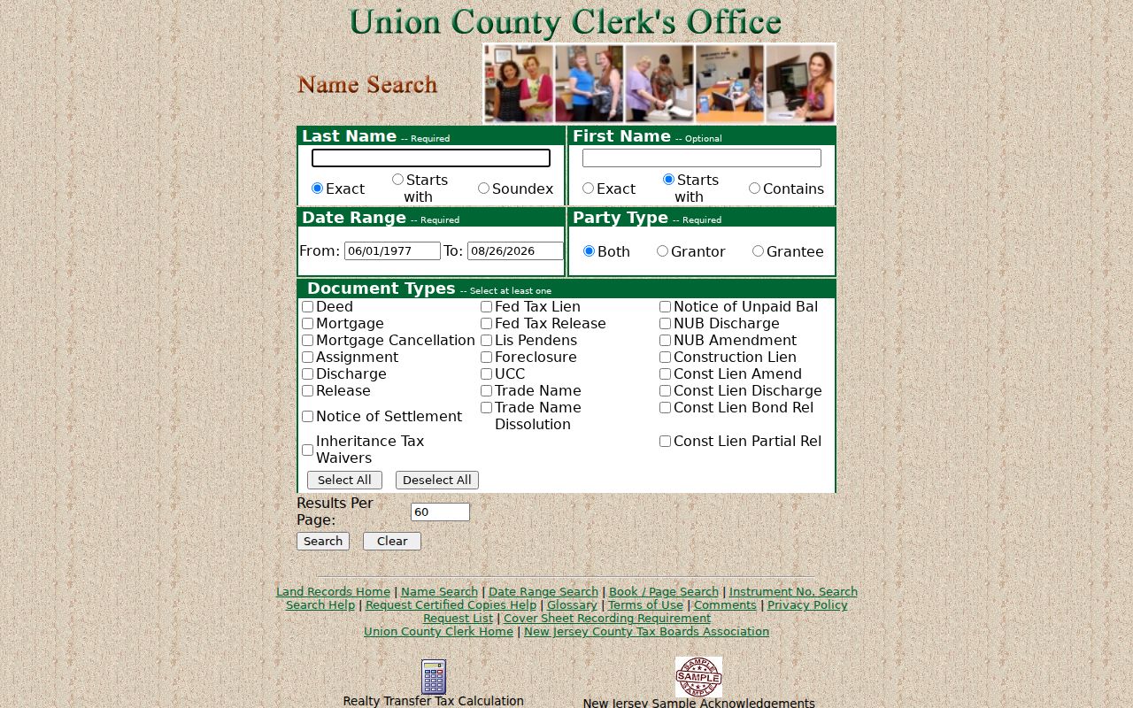
Its filters support a careful party-and-date search, not a claim that every historic instrument or image is immediately online.
Records before the online boundary move to the County Clerk Record Room, which retains real-estate transactions from 1857 onward. That office is the paper and historical-image fallback, and older land questions may require book, page, legal description, or tax-map context. County land records document a transaction, not everyone who lived at the location.
Union Address Source Coverage
Address records have different time ranges and limits. Use the source that matches the question instead of asking a single result to supply title, occupancy, postal validity, and neighborhood history at once.
| Address source | Union coverage | Best use | Key limit |
|---|---|---|---|
| Union USPS ZIP Lookup | Current Union address format | Confirm deliverability and standardization | Does not confirm a person or company. |
| Union NJGIN and tax data | Current or update-cycle Union parcel context | Find block, lot, geometry, and annual tax fields | Owner fields may be redacted; a polygon is not a survey. |
| Union County Clerk land records | Record Room from 1857; index from June 1, 1977 | Trace Union recorded conveyances | A deed does not prove occupancy. |
| Union Public Library directories | Listed volumes from 1942 to 2012, with gaps | Read a Union alpha or street section when present | Historical snapshot, not current verification. |
| Union local newspapers | 1928 to 2020 across three title collections | Find dated Union civic, property, or obituary context | Reports may be incomplete or about another person. |
| Union Digifind maps | Named 1904, 1920, 1928, and 1970 items | Reconnect Union lot layout and old street vocabulary | Map titles alone do not prove construction or occupancy. |
Union Street Directory Through Time
Union Public Library’s digitized directory collection lists uneven volumes from 1942 through 2012. The collection includes people, businesses, institutions, and locations, but missing years are part of the record, not evidence of an empty street. When a volume has a street section, read the target address and nearby entries, then compare the closest available years. The historical layer is a lead for a household, not proof of ownership or present residence.
Older street work benefits from the library’s map and newspaper collections. The Union Register spans 1928 to 1957, the Union Leader spans 1958 to 2005, and Local Source spans 2008 to 2020. A dated item can help explain a subdivision, civic event, or property story, but it should be paired with a directory, deed, or map before drawing a conclusion.
The Union Public Library map collection identifies local map leads including 1904 property material, the 1920 Laurel Heights Vaux Hall map, the 1928 Maplewood Park map, a 1970 township map, subdivision sheets, and a Sanborn item.
The Union Township Assessor page identifies the municipal office that maintains assessment, dimensions, tax maps, deductions, and appeals material.
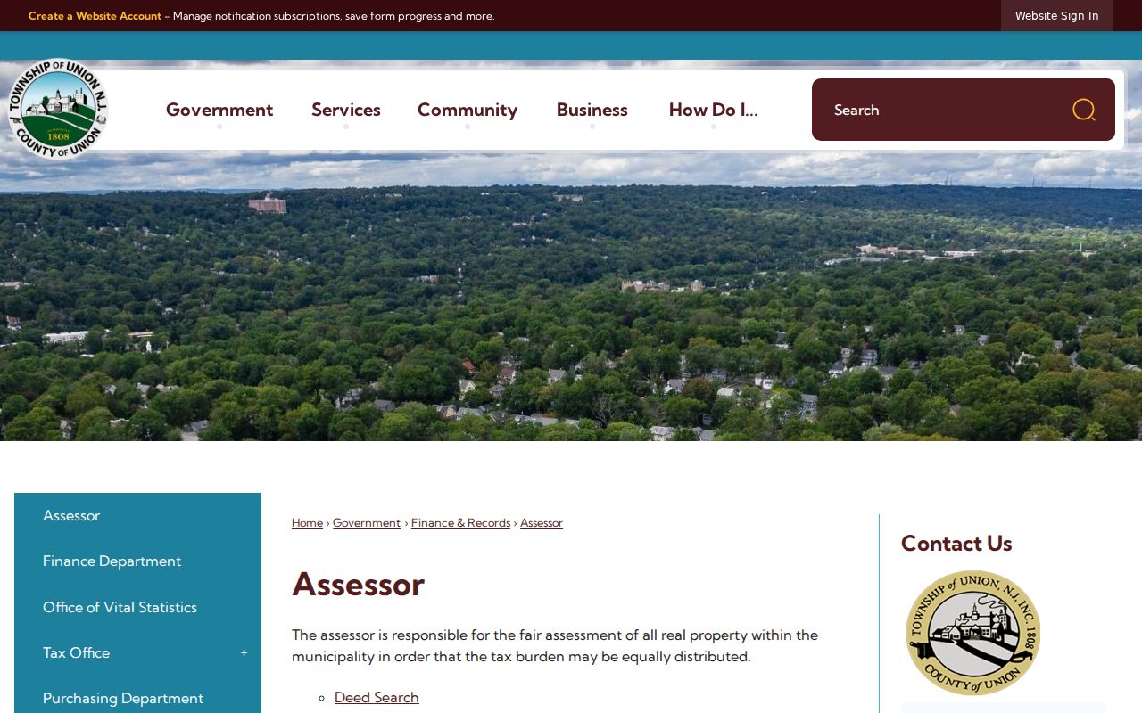
The Assessor image points back to the municipal office that maintains tax-map and assessment context when a historic street trail needs a local correction route.
Union Street Record Terms
Small record terms prevent large mistakes. Use the field names exactly as the office or scan presents them, especially when an address and a legal description point to the same place in different ways.
- Parcel
- A mapped piece of land identified in local tax and GIS systems, often by block and lot.
- Situs address
- The physical location of the parcel. It is not the same as a mailing address for tax correspondence.
- Plat or tax map
- A map record that locates lots, blocks, roads, and related parcel references. It is not a legal survey.
- Criss-cross directory
- An address or street arrangement within a directory volume. Union has no confirmed standalone reverse-directory series, so inspect each available volume.
A street section should be cited by volume, year, and page. An alphabetic entry can add a spelling or household clue, but the street placement still needs its own source check.
Union Street Poll Geography
Election geography can describe the civic setting of a Union street, but it should not be merged with parcel data. Block and lot identify land. Ward and district organize election administration. The County map layers supply those boundaries, while the state voter-status tool is for an individual’s registration status when the official service is available. During research, the live voter lookup returned a 403, so its exact form fields and result display were not verified.
The Union County polling-place workflow asks for ward and district. It is useful for confirming a public polling geography. It is not a public street-by-street list of residents. Preserve the election date and source date whenever a historical civic note is needed.
Union Street Crosswalks
Keep historic and modern forms in separate columns: original street spelling, modern form if supported, source, page, and date. Search abbreviation variants such as Road and Rd, Avenue and Ave, and historic Vaux Hall alongside current Vauxhall when the source calls for it. Digifind map titles also preserve names such as Laurel Heights, Oak Hill Park, Williams Tract, and Maplewood Park that can reconnect a subdivision sheet to a deed or directory.
No official Union Township street-renaming or renumbering list, public historic address register, or complete public address-keyed permit index was located. If a number sequence breaks, ask the Township Clerk for identifiable existing planning, tax-map, assessment-card, or building records through the appropriate records process. A missing permit response does not establish that a house or address never existed.
Note: Cite both spellings when a historical map differs from a current address, and avoid silently changing the original source wording.
Union Street Records at Town Hall
For a correction or clarification about assessment, dimensions, tax maps, deductions, or appeals, contact the Union Township Assessor at 1976 Morris Avenue, Union, NJ 07083, or 908-851-8505. The office is a correction route, not a public interactive owner-name search. Give the address, block and lot when known, and the record date that needs clarification.
The County Clerk certified-copy order page follows a selected search result and displays the instrument number, document type, recording date, page count, and quantity. It lists online payment and mail options. Its instructions state $8 for the first page and $2 for each additional page, with no stated processing-time guarantee; confirm current options before ordering.
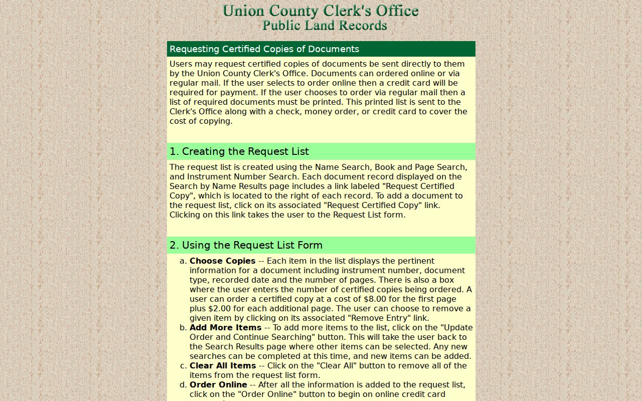
This screen is the copy-request stage after a Union street directory search identifies the correct recorded instrument.
Union Address Limits
A street record cannot establish every relationship to an address. Parcel and tax data may name an owner or show a redaction. A deed records a conveyance. A directory places a household or business in a specific historical edition. Postal data standardizes delivery information. None of those sources creates a complete list of occupants, and a current map should not be used to infer a private person’s presence.
Daniel’s Law and the New Jersey Address Confidentiality Program can protect addresses and related identifying information. Respect a source’s redaction, request corrections through the custodian, and leave protected information protected.